The Kingdom of Bhutan is the landlocked Buddhist nation in the central Himalaya. Regional fiefdoms were unified in the 17 century by a religious and military leader. Bhutan's first hereditary monarch was enthroned in 1097, and the country joined the United Nations in 1971. Bhutan is bordered by Chinese controlled Tibet to the north and India to south, east and west.
The word Bhutan mat have been derived from Sanskrit word meaning "end of Tibet" as Bhutan lies at southeast boarder of the Tibetan plateu. Bhutan is known as Druk Yul meaning "The Land of Thunder Dragon" in the Bhutanese Language og Dzongkha.
The country's topography is said to resemble the spine of dragon rising within 150 km (90mi) from near sea level at the lowlands in the south to over 7000 meters to the Tibetan frontier to the north. Ferocious storms, in part because of the abrupt and extreme altitudinal differences, contribute to the 'thunder' part of the name.
This extreme variation in elevation in short span of distance affords a wide range of climate, flora and fauna, geography and ecology, as Bhutan is declared as one of the world's ten global biodiversity "hotspots".
Vajrayana Buddhism is the official religion, and followers account 70% to 80% of the population. They are distinguished between dominant Drukpa sect in the west and Nyingmapa followers from the east. Hinduism, mainly practiced in the south, accounts for nearly 25% of the population. Bhutan's constitution forbids proselytizing.
Geography
A remarkable 26% of the entire country is designated and protected as National Park and Sanctuaries. The land of thunder dragon kingdom is a trekker's paradise and nature lover's dream as Nepal. With 72 percent of the country under forest cover, Bhutan's pristine ecology is home to rare and endangered flora and fauna.
The mountainous land of Thunder Dragon rises abruptly from the subtropical lowlands of the Enormous plain of northern India. The black mountains in the central region of Bhutan form a watershed between two major rivers systems: the Amochu and the Apochu. The southern area, known as Duars a 10 to 15 km wide (6 to 10 mi) alluvial plan make of mixed jungle, abundant wildlife and grassland. To the north of the Duars is a 65-80km wide region occupied by the Lesser Himalaya with an elevation between 1500 – 3000m (5000 – 10000ft)
Climate:
Duars – Hot, humid and subtropical
Inner Himalaya up to 2250m – Temperature zone (cool winter and warm summer)
Greater Himalaya (2250 – 4500m) – Cool Zone with pasturelands suitable for summer gazing and permanent snowline above 4500 meters.
Entry procedure:
Tourist can book a package holiday to the country through both international and local travel agency. The royal government of Bhutan sets minimum selling prices for these packages which must be paid in US Dollar prior to arrival in Bhutan.
High Season Rate: 250 per person per night for the months of March, April, May, September, October and November.
Low Season Rate: 200 per person per night for the months of January, February, June, July, August and December.
Visa Formalities:
Other than Indian, Bangladeshis and Maldivian nationals, all visitors to Bhutan require a visa issued from Thimphu. Application for tourist visa is submitted by a licensed tour operator directly or through a foreign travel agent. Visa clearance from Thimphu must be obtained before entering Bhutan and takes at least 10 days to process. Air tickets to Bhutan cannot be purchased without this clearance. At the point of entry the visa will be stamped on payment of US 40, two passport photos are required. Visas are issued for 15 day period. Extensions can be obtained in Thimphu at cost of Nu 510.
Places of interest to visit:
Paro:
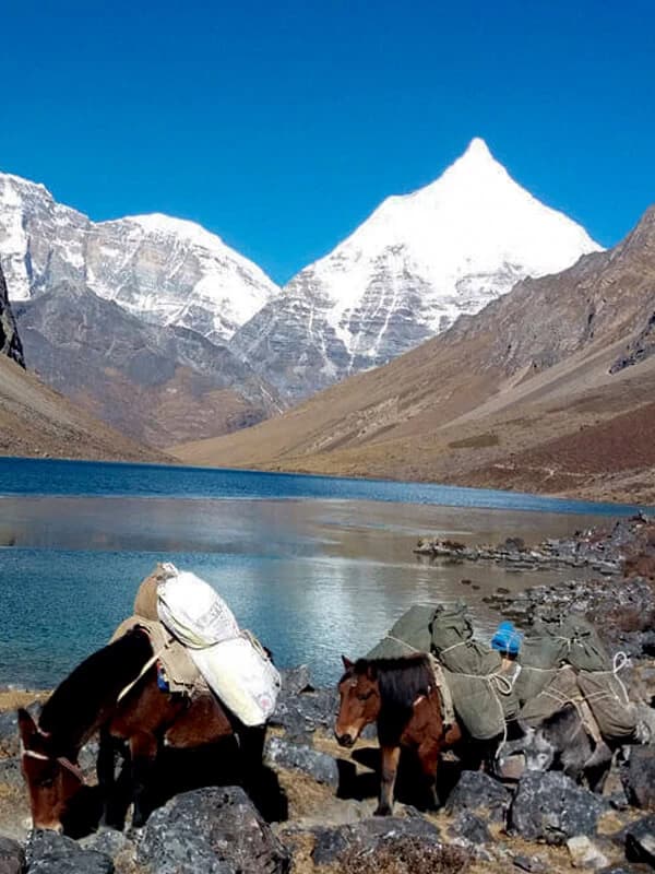
Paro (2240m) is Bhutan's only international airport. The valley offers the beautiful Jomolhari Trek (to a mountain revered as a Goddess) and has famous Drugkyel Dzong, Fortress of the victorious of Drukpa sect of Vajrayana Buddhism. The national museum and Paro Dzong are suggested additional sightseeing highlights. Taktsang "Tiger's Nest" monastery is Bhutan most famous is located on the side of 900m cliff above the Paro Valley.
Thimphu:
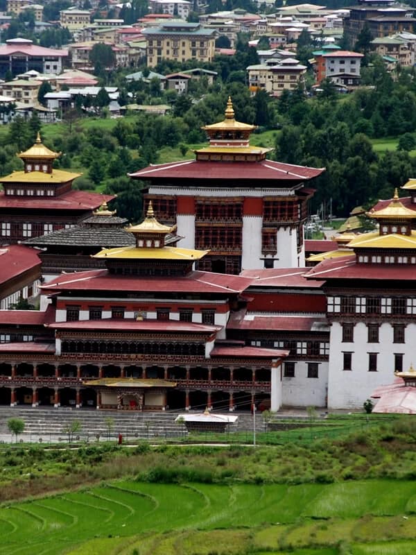
Thimphu (2350m), the capital of the country is 1.5 – 2 hours drive from Paro, and is widespread city. It boasts of a number of magnificent monuments including the Memorial Chortens to the father of modern Bhutan and Sirntokha Dzong, 6 kms from the city. Sirntokha Dzong is the country's oldest and is now used as a Dzongkha language school. There are many day long tours to the monasteries in the vicinity of Thimphu. Rice, corn, wheat fields provide serene surroundings. The city is directly linked to Phuntsholing on the Indian boarder by a 195-km road.
Punakha:
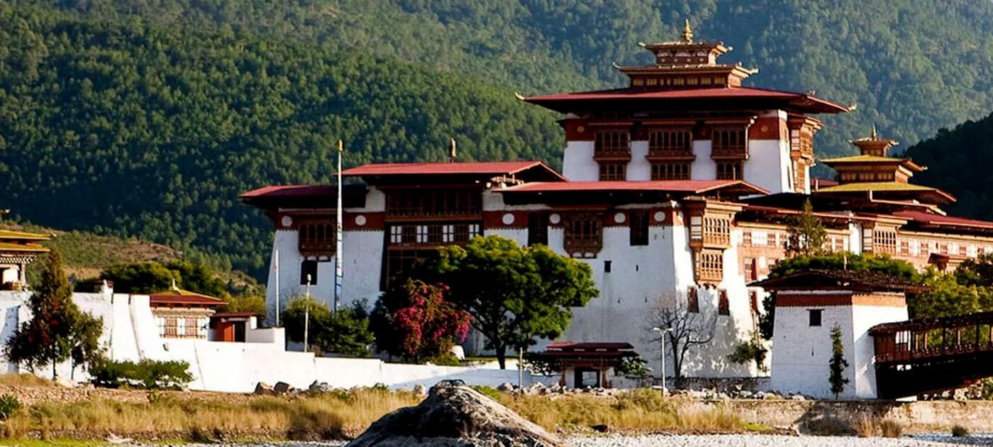
Punakha is the former winter capital of Bhutan. The highlights are Punakha Dzong meaning "Palace of the Happiness" located at confluence of the Amochu and Pochu (Mother and Father) rivers.
Wandgi Phodrang:
Wangdi Phodrang Dzong; sits majestically on a hill with a commanding views of the surrounding valleys. The bridge to Wangdi is more than 300 years old and Dzong fortress itself over 350 with monastic community and requires a special permit. Phobjikha Valley is the winter habitation of the Black –Necked Crane, an endangered species that migrates from Tibet and Siberia.
Trongsa:
Tongsa is the geographical center of Bhutan and the ancestral home of the royal family. The Tongsa Dzong is the longest in all of Bhutan and one of the most impressive. Chendebji Chorten lies at the confluence of the two rivers on the way to Tongsa, and is a replica of Boudhanath in Kathmandu.
Jakar:
The capital of Bumtang Region houses the Wangduchoding Palace and has mixture of the old and the new juxtaposed with each other. Jampey Lhakhang Monastery, built in the 7th century houses an image of Maitreya Buddha.
Mongar:
The drive to Mongar from Bumthang is perhaps the most scenic in Bhutan and crosses the Thumsing La pass at about 3800 meter with the dramatic panorama of the mountains before descending the 650 meter elevation. In the winter the pass can be closed for days due to snow fall.The descent passes through a road carved out of the side of the mountains with precipitous drop-offs in some sections.


